Ski resorts of Zakarpattia, the Carpathians
Zakarpattia oblast – mountains, skis, tracks, lifts
Dragobrat is the highest ski resort of Ukraine. It is located at an altitude of 1400 m above the sea level.
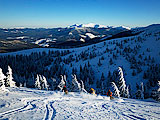
Such location of the resort ensures snow cover until late spring. Amazing landscapes, isolation from ‘civilization’, skiing beyond tracks and possibility of winter and spring skiing attract many tourists to this place.
Distances: Ivano-Frankivsk – 140 km.
Slopes: 1400 m, 3 tracks of average level of difficulty.
Lifts: 1 rope tow.
Maintenance of slopes:
How to get to this place: Ivano-Frankivsk – Yaremche - Rakhiv. You can get to this place by a regular bus, train, car through Yaremche.
Coordinates: : 48° 3′ 0″ N, 24° 13′ 0″ E
Pylypets is located between villages Mizhhiria and Volovets at an altitude of 750 m above the sea level. Winter rest in the Carpathians at Pylypets resort attracts first of all skiers and snowboarders.
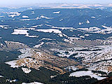
Tracks of different level of complexity are available on the neighboring mountains Gymba and Riapushka. Pylypets has three rope tows. Some slopes are gentle, some are steep and uneven. Freeride is very famous at this resort. The longest track is 4000 m, level difference is 150-900 m; there are gentle tracks for beginners at the foot of the mountain. There is equipment rental, instructors for beginners both of skiing and snowboarding. Picturesque waterfall Shypit is not far from Pylypets village and you can drive there on excursion. There is another resort Podobovets; it is not far from Pylypets and this peculiarity can diversify your wishes.
Distances: Lviv - 190 km, Uzhgorod - 135 km.
Lifts: rope tows of 400-1550 m, two-seated chair lift of 1650 m, level difference is 150-900 m.
Maintenance of tracks: snow groomer.
How to get to this place: You have to take trains towards Uzhgorod, Mukachevo or Prague up to the station Volovets, then to take regular buses or taxis to Pylypets village (15 km). If you travel by car you have to choose the highway Kyiv-Chop to Nyzhni Vorota village, then to turn to Volovets up to Pylypets village.
Coordinates: : 48° 40′ 12″ N, 23° 20′ 24″ E
Podobovets is located about 10 km from Volovets towards Mizhhiria at an altitude of 950 m above the sea level. Ski resort Podobovets is famous by its picturesque sceneries.
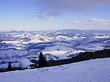
Podobovets resort is characterized by its long and steep slopes; it has tracks of different level of complexity. Low slopes are gentle and can be suitable for beginners; high slopes can have an angle at 45°. There are tracks for children as well. Some of tracks have lightening. Podobovets is famous by its “tubes”: a kind of tunnels in the forest. Freeride, so called skiing beyond the track, is very famous at this resort. There is equipment rental, instructor’s service, skiing and snowboard school. There is another resort Pylypets; it is not far from Podobovets and this peculiarity can diversify your wishes.
Distances: Uzhgorod - 120 km, Lviv – 200 km, Volovets village - 12 km.
Slopes: Several tracks of different level of complexity up to 4000 m, level difference is up to 400 m..
Lifts: several rope tows.
Maintenance of tracks: snow groomer, lightening some of tracks.
How to get to this place: You have to take a train to the station Volovets, then to Podobovets village (11 km) by regular buses or taxis. If you travel by car you have to choose the highway Kyiv-Chop to Nyzhni Vorota village, then to turn towards Volovets up to Podobovets village.
Coordinates: : 48° 40′ 31″ N, 23° 17′ 49″ E
Izky is a new ski resort which is located in Izky village in the direction from Volovets to Mizhhiria just behind Pylypets village at an altitude of about 700 m above the sea level.
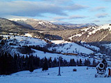
Izky is a new ski resort mostly oriented on corporate and family rest. This resort is located not far from popular resorts Podobovets and Pylypets. It attracts tourists by its gentle wide tracks and magnificent landscapes. Infrastructure is well-developed at this place; there is equipment rental as well as skiing school.
Distances: Ivano-Frankivsk – 137 km, Lviv – 190 km
Slopes: 700 m, there is a track of simple level of complexity of 1000 m, track of average level of complexity with width in a certain places up to 200 m.
Lifts: rope tow of 950 m and two-seated chair lift of 980 m.
Maintenance of tracks: snow groomer, snow cannons.
How to get to this place: To travel by train: you have to get to the station Volovets, from this station you have to take a regular bus to Mizhhiria. To travel by car: you have to choose the routes as follows: Lviv—Stryi—Nyzhni Vorota—Volovets—Izky — 190 km.
• Ivano-Frankivsk—Dolyna—Mizhhiria—Izky — 137 km. • Uzhgorod—Nyzhni Vorota—Volovets—Izky — 112 km.
Coordinates: : 48°64'13.5"N, 23°33'98.8"E
Lazeshchyna Zakarpattia oblast Rakhiv region
Lazeshchyna is a suitable place for beginners and convenient place for those who return from Hoverla Mountain peak. Most often Lazeshchyna stop tourists who travel to Bukovel ski to which 10-12 km. A price for rental housing in Lazeshchyna is much cheaper than it is in Bukovel. The distance from Lazeshchyna to Yasynia is few kilometers. Yasynia is often an intermediate point during a trip to Dragobrat. This track is gentle and short.
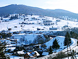
Nearest ski resorts: Yasynia (3,7 km), Yablunytsa (9,7 km), Dragobrat (18,3 km), Bukovel (20,6 km), Vorokhta (25,7 km), Rakhiv (34,8 km), Yaremche (40 km).
Distances: Ivano-Frankivsk – 75 km, Rakhiv – 34,8 km.
Slopes: 500 m, a track of simple level of complexity, level difference: 80 m..
Lifts: 1 rope tow of 350 m..
Maintenance of tracks:.
How to get to this place: You have to get to Ivano-Frankivsk, then towards Rakhiv or to take a train Lviv-Rakhiv. You also may take a regular bus or train; by your own car you have to drive through Yaremche towards Rakhiv. To travel by car: Ivano-Frankivsk-Mukachevo (H-09) to Lazeshchyna village.
Coordinates: : 48°16'21.01''N, 24°24'52.18''E
Yasynia Zakarpattia oblast Rakhiv region
Yasynia is located at an altitude of 650 m above the sea level in the foothills of mountains such as Hoverla, Petros and Blyznytsa. Both summer and winter rest is possible in Yasynia. Many walking tours begin in Yasynia. Buses are walking constantly in the winter from Yasynia to Bukovel (12-15 km). Also in Yasynia you can take a taxi to Dragobrat. Most tourists traveling by car and planning to rest on Dragobrate resort leave their cars on the paid parking near
the hotel "Edelweiss" in Yasynia.
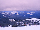
Yasynia in winter is a famous ski resort. Tracks and rest in Yasynia are intended mostly for beginners. Ski tracks of Kosterivka Mountain are simple; in Mlaky hole tracks are average. There is equipment rental as well as instructor’s service. For advanced skiers 18 kilometers from this place is another ski resort Dragobrat. It is possible to get to Dragobrat from Yasynia village for only 1 hour (and of course it depends on weather conditions).
Distances: Ivano-Frankivsk – 100 km, Rakhiv – 32 km.
Slopes: Yasynia – Kosterivka Mountain – 500 m, low level of complexity, Yasynia– Mlaky hole– 800 m, average level of difficulty.
Lifts: rope tows.
Maintenance of tracks:
How to get to this place: You have to take a train from Ivano-Frankivsk or by a regular bus. If you travel by car you have to choose the road from Ivano-Frankivsk through Yaremche.
Coordinates: : 48° 15′ 32″ N, 24° 21′ 18″ E
Beautiful view to Menchul Mountain, which is located directly in this place, you may also see Chornohora range as well as to the highest mountain of Ukraine Hoverla from this place.
There are tracks for beginners and of average level
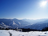
of difficulty for those who want to improve their own skills. This place attracts skiers by frequent changes of inclination angle. It is a good start for beginners, inexpensive instructor’s service; it is easy to get to this place.
Distances: Uzhgorod – 186 km, Rakhiv – 40 km, Velyky Bychkiv railway station – 12 km.
Slopes: two slopes of 500 – 800 m, for beginners and lovers of skiing.
Lifts: 2 rope tows.
Maintenance of slopes:
How to get to this place: Nearest railway stations are Velyky Bychkiv, Bogdan. The most convenient way is from Rakhiv taking by a regular bus getting to this place.
Coordinates: : 48° 4′ 56″ N, 24° 4′ 29″ E
Kobyletska Poliana Zakarpattia oblast
Two slopes with length of 500 and 800 m, there is equipment rental, instructors, car parking. Level difference is 50 and 80 meters.
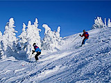
Width of ski tracks at tourist complex “Trembita” in Kobyletska Poliana village reaches 100 meters. Three kilometers from tourist complex “Trembita” another tourist complex “Pereval” is located (850 m above the sea level).
Distances: Uzhgorod – 186 km, Rakhiv – 40 km, Velyky Bychkiv railway station – 12 km.
Slopes: two slopes of 500 – 800 m, for beginners and lovers of skiing.
Lifts: 2 rope tows.
How to get to this place: Nearest railway stations are Velyky Bychkiv, Bogdan. The most convenient way is from Rakhiv taking by a regular bus getting to this place.
Coordinates: : 48° 4′ 56″ N, 24° 4′ 29″ E
Chorna Tysa village, ski sports school
Sukrovytsa Mountain, road – 200 m, track is 400 m, level difference is 60 m, equipment rental. This track is gentle and short.
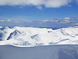
Slopes: 500 m, level difference is 60 m.
Lifts: 1 rope tow of 200 m.
How to get to this place: you have to take a regular bus Rakhiv-Chorna Tysa
Coordinates: : 48° 18′ 31″ N, 24° 19′ 35″ E
Bogdan Zakarpattia oblast Rakhiv region
Bogdan is a picturesque village of the Ukrainian Carpathians which is located between Petros and Hoverla Mountains on the both banks of Tysa River.
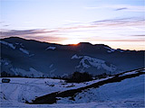
Bogdan village is 15 kilometers from Rakhiv. This place attracts tourists by its amazing winter landscapes of Chornohora range, Tysa River.
Distances: Ivano-Frankivsk – 160 km.
Slopes: 1500 m, there is a track of average level of difficulty.
Lifts: rope tow.
Maintenance of tracks: snow groomer.
How to get to this place: Ivano-Frankivsk – Rakhiv, then you have to take a regular bus or a taxi. To travel by car: Ivano-Frankivsk – Yaremche - Rakhiv
Coordinates: : 48° 2′ 9″ N, 24° 20′ 35″ E
Novoselytsa Zakarpattia oblast Perechyn region
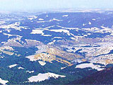
Rope tow of 950 meters, level difference is 270 meters; capacity is 850 people per hour. There is a track of 1200 meters as well as snow groomers, equipment rental, coffee houses, car parking.
Distances: Uzhgorod – 40 km.
Slopes: 1200 m, there is a track of average level of complexity, level difference is 270 m.
Lifts: rope tow of 950 m.
Maintenance of tracks: snow groomer.
How to get to this place: You have to take a regular bus from Uzhgorod or a taxi from Dubynychi station. To travel by car – you have to choose the road towards Uzhgorod through Sambir and Turka
Coordinates: : 48° 47′ 34″ N, 22° 25′ 1″ E
It is located at an altitude of 1000 m above the sea level. Mountains covered with deciduous forests, there are amazing views around. There is plenty of space for all tourists: from beginners to experienced skiers.
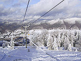
Tracks are long enough at this resort, they reach of 3500 m. There are tracks for beginners and average skiers. Snow cannons and snow groomers are available only at the low track.
Distances: Uzhgorod – 67 km.
Slopes: 3900 m, there are several tracks of different level of complexity.
Lifts: chair lifts, a rope tow and a rope tow for children, there is no lightening.
Maintenance of tracks: snow groomer, snow cannons in some places and lightening.
How to get to this place: You have to take a regular bus or a taxi from Uzhgorod towards Vyshka village. To travel by car – from Uzhgorod through Perechyn or from Lviv on the road to Uzhgorod through Sambir and Turka.
Coordinates: : 48° 56′ 19″ N, 22° 42′ 33″ E
Solochyn Zakarpattia oblast Svaliava region
There are three tracks of average level of complexity. Skiers are those who have come for treatment and rest. Resorts “Kvitka polonyny” and “Kryshtaleve dzherelo” are located near this place. Lifts lead to the mountain of an altitude of 860 meters.
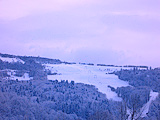
There is equipment rental and instructor’s service. Length of all tracks of Solochyn resort is about 1000 meters, level difference is more of 200 meters, width of tracks are 50 meters.
Distances: Mukachevo – 35 km. Svaliava – 8,5 km.
Slopes: about of 1000 m, average level of complexity.
Lifts: rope tow and 2 multi-lifts of 300, 400 m.
Maintenance of tracks: snow groomer.
How to get to this place: You have to take a train towards Svaliava, then to take a regular bus or a taxi. If you travel by car you have to choose the highway Kyiv-Chop through Poliana village.
Coordinates: : 48° 36′ 1″ N, 22° 57′ 23″ E
Poliana Zakarpattia oblast Svaliava region
There is a track for beginners, equipment rental; level difference is 40-70 m. This place is suitable for those who want to combine rest and treatment.
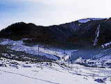
Distances: Mukachevo – 35 km.
Slopes: 300 - 700 m, average level of complexity.
Lifts: several rope tows.
Maintenance of tracks:.
How to get to this place: You have to take a train towards Svaliava, then to take a regular bus or a taxi. If you travel by car you have to choose the highway Kyiv-Chop, then to turn to Svaliava and after to Poliana village.
Coordinates: : 48°37′31″ N.22°58′11″ E
There are three tracks of average and simple level of difficulty, a track for beginners. There is equipment rental as well. A lot of skiers from Mukachevo come here on weekends.
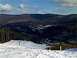
It is a nice place who wants to combine rest and treatment.
Distances: Mukachevo – 25 km.
Slopes: 400 - 1200 m, 2 tracks of average and simple level of difficulty.
Lifts: 2 rope tows and a baby-lift of 350 m.
Maintenance of tracks: snow groomer, snow cannons.
How to get to this place: You have to take a train to the stations Mukachevo or Carpathians, then to take a regular bus or a taxi. If you travel by car you have to choose the highway Kyiv-Chop through Poliana village, Carpathians towards Syniak.
Coordinates: : 48° 34′ 41″ N, 22° 51′ 28″ E
Voyevodino (Turya Pasika) Zakarpattia oblast Perechyn region
Rest in the Carpathians in Voyevodino. It is a place where wild nature and all civilization welfare exist together. This resort is situated between Svaliava and Perechyn. There are tracks of average level of difficulty and a track for children.
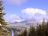
Level difference is up to 100 m. There are equipment rental including equipment for children, entertainment both for children and adults. Instructor’s service is available here as well. It is a comfort place for beginners training; besides this place is a distant enough from so called ‘civilization’. There are transfers to the lifts to Krasiya, Lumshory, Solochyn village, Syniak resort.
Distances: Uzhgorod – 50 km. Perechyn – 18 km.
Slopes: 900 m, tracks of average level of complexity, for beginners, for children.
Lifts: rope tow, baby-lift.
Maintenance of tracks: snow groomer, lightening.
How to get to this place: You have to take a train towards stations Uzhgorod or Svaliava, then to take a regular bus. If you travel by car you have to choose the highway Kyiv – Chop through Poliana village, from Uzhgorod through Perechyn, then according to the sign towards Voyevodino.
Coordinates: : 48°39'46''N, 22°38'40''E
Mizhhiria Zakarpattia oblast Mizhhiria region
Winter rest in the Carpathians in Mizhhiria is characterized by availability of tracks of average level of complexity. There are three tracks, the longest of them is of 2500 meters, and the shortest is of 1500 meters.
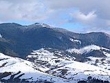
There is a three-seated chair lift to Makovytsa Mountain, several rope tows, equipment rental, instructor’s service and amazing views from the mountain and from the lifts. Rest in Mizhhiria can be combined with treatment by mineral water; mineral springs reaches up to several dozen. Soimy resort is located in Mizhhiria region.
Distances: Lviv – 200 km.
Slopes: Several tracks of average level of difficulty up to 2000 m, level difference is 303 meters.
Lifts: rope tow and chair lift.
Maintenance of tracks:.
How to get to this place: You have to take a train towards Uzhgorod, Mukachevo or Prague up to the station Volovets, then to take regular buses or taxis to Mizhhiria. If travel by car you have to choose the highway Kyiv-Chop to Nyzhni Vorota village, then to turn to Mizhhiria.
Coordinates: : 48°31′43″N 23°30′07″E
Verkhniy Studeny (Beskyd) Zakarpattia oblast Mizhhiria region
Verkhniy Studeny village is located on the road between Volovets and Mizhhiria just behind Pylypets village at an altitude of 710 meters above the sea level.
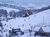
There are three rope tows and one ropeway; tracks are suitable for beginners, slopes are gentle, level difference is 160 - 200 m. Verkhniy Studeny is famous for its ski resort complex “Beskyd”. There is equipment rental, instructor’s service as well.<
Distances: Lviv – 208 km, Volovets – 24 km.
Slopes: tracks for beginners and lovers of skiing, from 400 to 1200 m.
Lifts: rope tows.
Maintenance of tracks:.
How to get to this place: You have to take a train towards the station Beskyd. If you travel by car you have to choose the highway Kyiv-Chop, then to turn to Volovets.
Coordinates: : 48°44'12.12''N, 23°21'12.24''E
Kalyny Zakarpattia oblast Tiachiv region
This village is located in the Valley of Teresva River, 36 km from Tiachiv and 25 km from railway station Teresva. There is a track of simple level of difficulty, but tracks of higher level of difficulty are being constructed.
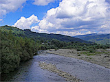
There is equipment rental, instructor’s service as well as snow cannons. Availability of snow cannons and construction of new tracks makes it promising ski resort in the near future.
Distances: Mukachevo – 130 km.
Slopes: 500 m, simple but there are new tracks under construction.
Lifts: rope tow.
Maintenance of tracks: snow groomer, snow cannons.
How to get to this place: You have to take a train to Mukachevo, Uzhgorod, then to take a regular bus to Tiachiv, then to Kalyny. You may also take a train to the station Teresva, then to take a bus or a taxi to Kalyny. If you travel by car you have to drive through Rakhiv to Ust-Chorna.
Coordinates: : 48.139444°, 23.866944°
Ust-Chorna Zakarpattia oblast Tiachiv region
This village is located among Gorgany Mountains at an altitude of 553 m above the sea level. Picturesque mountains, rivers make this area special. There tracks of different level of difficulty with length about of 1000 m. There is a rope tow, tourist resort “Yalynka”, several hotels and private sector. Different service and entertainment are provided there: paintball, equipment rental, snowboards, sleds, snow tubing etc.
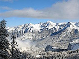
Several tourists’ tours start in Ust-Chorna and they are as follows: to dale Krasna, to Svydovets, to Vododilny Gorgany. This resort is popular both in winter and in summer.
Distances: Mukachevo – 170 km.
Slopes: 600 m, tracks of different level of complexity.
Lifts: rope tow.
Maintenance of tracks:
How to get to this place: You have to take a train to Mukachevo and then to take a regular bus or a taxi. If you travel by car you have to drive the following routes: Ivano-Frankivsk – Yablunytsa pass – Rakhiv – Teresva - Dubove - Ust-Chorna or through Mukachevo – Khust – Tiachiv – Teresva – Dubove – Ust-Chorna.
Coordinates: : 48°19′09″N 23°56′20″ E
Zhdeniyevo Zakarpattia oblast Volovets region
The village is situated in Volovets region at an altitude of 542 m above the sea level; it is not far from Pikuy Mountain. There is equipment rental, instructor’s service as well.
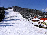
Resorts Podobovets 33,9 km and Pylypets 37 km are located next to this village.
Distances: Lviv – 180 km, Volovets - 25 km, Svaliava - 33 km.
Slopes: about 800 m, level difference is about 160 m.
Lifts: rope tow.
Maintenance of tracks: snow groomer.
How to get to this place: You have to take a train to Volovets station, then to take a regular bus or a taxi. If you travel by car you have to choose the highway Kyiv-Chop, in Volovets region to turn to Zhdeniyevo - 15 km from the highway.
Coordinates: : 48° 46′ 14″ N, 22° 58′ 46″ E
Osiy Zakarpattia oblast Irshava region
Two tracks of average and simple level of difficulty, tracks for beginners. There is an equipment rental. There are a lot of tourists from Mukachevo on weekends.
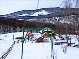
Distances: Mukachevo – 50 km.
Slopes: 2 tracks of 600 m and of 800 m, level difference is 60-70 m.
Lifts: rope tow of 300 m.
Maintenance of tracks: lightening of the rope tow.
How to get to this place: You have to take a regular bus from Svaliava to Irshava, then to take a taxi to Osiy village. If you travel by car you have to choose the highway Kyiv-Chop, then leaving Mukachevo you have to turn to Irshava, natural reserve “Zacharovany kray” towards Osiy village.
Coordinates: : 48° 21′ 37.30″ N, 23° 07′ 00.20″ E