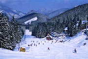
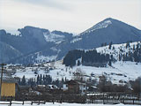
Rest in the Carpathians
Ski resorts of Prykarpattia – mountains, skis, tracks, lifts
Polianytsa (Bukovel) Ivano-Frankivsk oblast Yaremche municipality (Carpathians)
Polianytsa became popular because of its location next to the resort “Bukovel” and it is situated at an altitude of 860-890 m above the sea level.

Due to its location and snow cannons snow cover remains long period and winter rest in the Carpathians lasts until late spring. Season 2013 here started at the beginning of December. This resort was constructed like many other European resorts with the equal service.
Distances: Ivano-Frankivsk – 90 km.
Slopes: more than 80 tracks with total length of 50 km, track for mogul skiing, giant slalom.
Lifts: 14 chair-seated lifts, 1 rope tow, multi-lift.
Maintenance of tracks: snow groomer, snow cannons, lightening.
How to get to this place: From Ivano-Frankivsk to Yaremche, then towards Bukovel. In season from surrounding villages in a radius of 20-30 km there are regular buses to Bukovel.
Coordinates: 48°21'30"N, 24°24'28"E
Iltsi Verkhovyna region (Carpathians)
This village is located near center of Verkhovyna region in the valley of the river Chorny Cheremosh. It has a well-developed private sector allowing having good inexpensive rest in the Carpathians.

Distances: Ivano-Frankivsk – 145 km, Verkhovyna - 6 km
Slopes: track of average level of difficulty of 700 m.
Lifts: 2 rope tows.
How to get to this place: From Ivano-Frankivsk to Yaremche; from Chernivtsi you have to choose the road towards Kosiv and Verkhovyna.
Coordinates: 48° 9′ 11″ N, 24° 45′ 36″ E
Yablunytsa is located at an altitude of 900 m above the sea level. It is a famous ski resort. There are magnificent sceneries in this area. This resort provides inexpensive accommodation, lifts to different mountains, equipment rental.

There are people who prefer to rent accommodation in Yablunytsa and skiing in Bukovel (14 km).
How to get to this place: від Івано-Франківська через Яремче
Coordinates: 48°18'51.12"N, 24°31'36.48"E
Vorokhta Ivano-Frankivsk oblast Yaremche municipality (Carpathians)
It is located at an altitude of 800-850 m above the sea level. It was known as a training center of winter sports. It has ski jumps, biathlon trails, cross-country skiing.

This resort provides inexpensive accommodation, amazing landscapes; you may have an opportunity skiing both here and in Bukovel. There is equipment rental for children as well as for adults.
Distances: Ivano-Frankivsk – 120 km, Bukovel - 14 km.
Slopes: Several slopes of 1500 m of different level of complexity.
Lifts: 10 rope tows, level difference is up to 280 m.
Maintenance of tracks: lightening.
How to get to this place: from Ivano-Frankivsk through Yaremche.
Coordinates: 48°17'5.28"N, 24°34'5.52"E
Kosiv Ivano-Frankivsk oblast Kosiv region (Carpathians)
Kosiv is a cultural and tourist center of Hutsulshchyna. This area attracts of its Hutsul color, waterfalls and beautiful landscapes. There are tracks of different level of complexity for skiing

and snowboarding. This resort provides inexpensive accommodation and the largest souvenirs’ market in Ukraine.
Distances: Ivano-Frankivsk – 113 km.
Slopes: two tracks for downhill of 1200 m, track of special slalom of 500 m, giant slalom of 1000 m, track with artificial snow.
Lifts: two rope tows: the first of 1 000 m with level difference of 250 m and another lift of 250 m with level difference of 75 m.
How to get to this place: From Ivano-Frankivsk through Kolomyia, from Chernivtsi through Sniatyn. If you travel by train you have to take a train towards Ivano-Frankivsk, then you have to take a regular bus to get to this resort.
Coordinates: 48°19'11.46"N, 25°5'29.97"E
Sheshory Ivano-Frankivsk oblast Kosiv region (Carpathians)
This ski resort is located at an altitude of 600 m above the sea level. The features of this resort as follows: Silver Cascade of waterfalls and one of the most beautiful waterfall is Sheshory Guk.

There is a possibility of skiing, snowboarding, sledding etc. There is a freestyle school for children. Snow cover remains for a long period.
Distances: Ivano-Frankivsk – 100 km, Chernivtsi - 60 km.
Slopes: three tracks of 1500, 700 and 800 m of average level of difficulty.
Lifts: rope tow of 800 m, level difference is 150 m.
Maintenance of tracks: snow groomer, snowmobile.
How to get to this place: From Ivano-Frankivsk through Kolomyia.
Coordinates: 48°20'2.89"N, 24°59'9.65"E
Tyudiv Ivano-Frankivsk oblast Kosiv region (Carpathians)
It is located 16 km from Vyzhnytsia on the territory of national park “Hutsulshchyna”. This resort is suitable both for family and individual rest, it has amazing sceneries; it has well-developed infrastructure as well. It also provides skiing snowboarding, sledding, snowmobiling.

There are also snow tubing, paragliding, horse ridding...
Distances: Ivano-Frankivsk – 113 km.
Slopes: tracks of 200, 600 and 800 m, including for beginners.
Lifts: lift of 800 m, two-seated chair lift of 1500 m.
Maintenance of tracks: lightening of tracks.
How to get to this place: From Ivano-Frankivsk towards Kosiv, then you have to take a regular bus to Tyudiv.
Coordinates: 48°14'13"N, 25°6'32"E
Guta Ivano-Frankivsk oblast Bogorodchany region (Carpathians)
Guta is a starting point of many tourists’ routes. There is a ski lift in the resort “Synogora” which is located at an altitude of 600 m above the sea level.

Distances: Ivano-Frankivsk – 60 km, station Bogorodchany - 35 km
Slopes: track of 500 m, it is simple.
Lifts: rope tow
How to get to this place: From Ivano-Frankivsk you have to take a regular bus or a car through Bogorodchany and Solotvyn.
Coordinates: 48° 39′ 4″ N, 24° 12′ 55″ E
Vyshkiv Ivano-Frankivsk oblast Dolyna region (Carpathians)
It is located at an altitude of 930 m above the sea level. This village is situated among beautiful high mountains next to the road Dolyna — Khust. It is an inexpensive rest, there are no crowds and queues of tourists, but it has poorly developed infrastructure.

Distances: Ivano-Frankivsk – 100 km.
Slopes: tracks of 400 m and 1000 m of simple and average level of difficulty.
Lifts: two rope tows of 1000 m and 400 m.
How to get to this place: from Ivano-Frankivsk through Dolyna town.
Coordinates: 48° 43′ 37″ N, 23° 39′ 26″ E
Due to constant updating and development of ski resorts of Lviv oblast information about tracks, lifts can be changed and be different from those stipulated on the website.